Tag Archives: giant sequoias

Sherman Peak Hike

Standard

It wasn’t my finest hour.

I was lying face down in the middle of the trail, crying and whining.

I was not having fun. I did not want to go on.

The Man stood a few feet ahead of me on the trail and looked at me incredulously.

Do you want to quit? he asked, not unkindly. Do you want to go back to camp?

I know he would have accepted it if I had said yes to either or both questions.

I was miserable, but I was also determined or at least stubborn. I hauled myself to my feet and wiped the tears and snot from my face with the sleeve of my tie-dyed button-down shirt.

Let’s keep going, I said.

One of the giant sequoias with which visitors could get up close and personal .

The whole ordeal started with a camper.

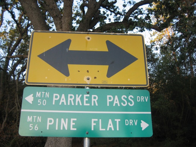
The Man was the camp host a the tiny campground where we stayed that summer. I worked down the road at the store near the trailhead of a popular trail where visitors could get up close and personal with giant sequoias.

One day The Man was talking to one of his campers. The camper told him about the great hike he’d been on. The hike wasn’t very long, only a couple of miles, and the view at the end was amazing. The camper encouraged The Man to go on the hike.

The Man told me about the conversation wit the camper. He asked if I wanted to go on the hike with him on our next day off. I said sure.

Sunlight through the pine needles

I would not call myself a hiker. I like to see natural beauty, and sometimes I have to walk around to do that. I’m not big on elevation changes; I’d rather walk along a flat path. I’m not big on long distances either. Give me a mile loop to conquer, and I’m perfectly happy. A hike consisting of a mile in and mile back is in my comfort zone.

Somehow, I didn’t give much thought to a hike of a couple of miles probably being a four mile round trip. Certainly the camper was a better hiker than I was. Probably a four mile round trip hike was easy for him. It was not easy for me.

Life and death

According to the All Trails website, the Sherman Pass Trail to Sherman Peak (in the Sequoia National Forest) is

a 4.4 mile lightly trafficked out and back trail located near Kernville, California that offers the chance to see wildlife and is good for all skill levels.

One of the folks who left a review on their hike to Sherman Peak in June of 2019 recorded “an elevation gain of 994 feet.”

The SummitPost website’s page about Sherman Peak says,

Sherman Peak, elevation 9,909 feet, is on the eastern side of Sequoia National Forest on the edge of the Kern Plateau. It affords tremendous 360 degree views of the Great Western Divide, the Sierra Crest including Mt. Whitney, Langley, and Olancha, and a bird’s eye view of the Kern River Canyon and Little Kern River drainage.

A flower I encountered somewhere along the trail

I wasn’t in a good mood when we left the campground.

The Man and I were having relationship issues. I wasn’t sure if we would both be able to get our needs met. I felt like I was doing more than my share of the emotional work. I didn’t know how to solve our problems.

I wasn’t happy at work either. The yurt I worked in was always hot. One of my coworkers was difficult to get along with. The tourists seemed dumber than they had been in the past.

I would have preferred staying at our campsite and taking it easy that day. I would have enjoyed working on some blog posts, reading a book, taking a nap. However, The Man seemed to want to go on the hike, and I was pleased that he’d suggested an activity for us to do together, so I said yes.

We got a late start.

When I have an activity planned, I like to get started early. I prefer to start my summer hikes in the morning before the heat of the day sets in. I like to complete my physical activity early so I can spend the afternoon relaxing before cooking and eating dinner.

It was mid-morning before we boarded the minivan and embarked on our journey. The Man drove for a long time before we arrived. As one of the reviewers of the hike on All Trails said, this trail “is a long way from anywhere….”

Here’s the sign that lets visitors know they have reached the Sherman Pass Vista.

The Man parked the minivan in the paved parking area at the Sherman Pass Vista. The camper had told The Man this was the best place to leave the vehicle when going on the hike. After making use of the pit toilet in the parking area, we crossed the road and found the sign marking the beginning of the trail.

The hike started our easy. The trail was relatively flat, and we were making good time without overexerting ourselves. Jerico the dog was having a great time.

We soon found that no one had been maintaining the trail. In some places we had difficulty determining where the trail actually was. There were no markers, no cairns. I was afraid we were going to wander off the path, into the forest, and to our eventual deaths. The Man continued to boldly go. I continued to follow.

The trail got worse.

In several places, trees had fallen across the path. A couple of times I had to climb over fallen trees. The Man’s long legs allowed him to step right over the downed trees, but I had to climb on top of each lot, sit in the middle, then swing one leg and then the other over.

In one spot, I had to crawl under a dead tree lying across the path. I’d never before encountered such an obstacle in my limited hiking experience.

Somehow we ended up picking our way through a patch of large rocks. The Man had lost the trail and accidentally brought us through the rocky area. The rocks were all in a jumble, so there wasn’t really space to walk between them. We basically had to walk on top of the rocks or put our feet in the crevices between them. The rocks were jagged, so walking on top of them was not an easy option. I was worried I would slip from the top of a rock and twist an ankle or bust a knee.

When we finally made it out of the rock field and found the trail again, our uphill battle became steeper. We were definitely gaining in elevation now.

It was some time after this that I lay down in the middle of the trail and felt sorry for myself.

We were definitely going up in elevation now.

Another problem I was having on the hike was that The Man walks a lot faster than I do. He has longer legs. He used to be a runner , so his body has muscle memory of going fast. Also, he’s impatient. He crunches his cough drops before they can dissolve in his mouth, and he surges ahead whenever we’re on a hike together.

Even though he was carrying his guitar so he could play when we reached the summit, he kept leaving me in the dust that day. Before we began the hike, I’d imagined going on an easy walk together. Instead I was looking at the back of my partner’s head in the distance.

Granted, my mood had moved from bad to foul, and I wasn’t pleasant to be around. Hell, I didn’t even want to be with me, but I was stuck. I could understand why The Man wanted to walk ahead and be alone, but feeling abandoned only made my outlook worse.

More than once The Man stopped and waited for me to catch up. Several times he asked if I wanted to turn around and go back to the minivan and head back to the campground. Each time I wanted to quit, I ultimately decided to keep going. I was fully entrenched in the sunk cost fallacy which occurs, according to Behavioral Economics website, when people

continue a behavior or endeavor as a result of previously invested resources (time, money or effort) (Arkes & Blumer, 1985).

We’ve come so far, I thought. Surely we’re not far from the top.

I saw a lot of The Man’s back during our hike to Sherman Peak.

The trail took us higher and higher. The Man disappeared around a bend. I sat down again and cried some more.

I stood up and continued up the trail.

The camper had said the view from the peak was excellent. I hoped it would be worth all our struggles.

Another day, another tree

I came to a point where the trail forked. I could go left or right. The Man was nowhere in sight. Which way should I go?

I picked left more or less at random. I made the right decision. Next thing I knew, the trail had ended. I’d made it to the top! There was The Man and Jerico the dog.

I looked around. We were on the top of an enormous chunk of rock. There was little grass, a few evergreen trees, and some low bushes. One tree with branches low to the ground provided a bit of shade we utilized to get out of the sun.

I looked off into the distance. The view was nice…if a person had never been to Utah and seen the magnificent red rock formations.

To be fair, the view was nice in a California Sierra Nevada way. If I’d never seen that view, I might have been awestruck, but I’d seen what amounted to the same view several times in the prior three years. I’d seen basically that view from Dome Rock half a dozen times. I’d seen that view from Beetle Rock and Moro Rock in the Sequoia National Park. I couldn’t believe I’d just done a treacherous hike and the payoff was something that felt totally familiar.

This is the view I saw from Sherman Peak. The Man drove us up that road to get us to Sherman Pass Vista.

I’d thrown a few granola bars in my pack before we’d left camp. The Man and I sat in the little shade provided by the evergreen tree with low branches and each scarfed down a couple of granola bars and gulped from our water bottles. The Man took out the guitar he’d carried hundreds of feet up and played a bit, but he didn’t have much energy for jamming. We were both tired, hungry, thirsty, and we still had to walk back to the minivan.

The Man played a few tunes and Jerico rested before we headed back down the trail.

After we’d rested a bit, we looked around. There was a wooden shed up there as well as another little building and what I learned later was a radio transmitter. (I don’t know what it was transmitting or to whom.) The were a couple of large propane tanks up there too, but I don’t know if they were full or what the propane might be used for.

Once we were done poking around at the peak, we began our descent. At least our tired legs didn’t have to climb, although other little used muscles complained about going down. We managed to miss the rock patch this time. The worst was behind us.

At the peak we found a wooden shed, propane tanks, and radio transmitter.

Back on the road, we discussed going out of our way to the town with the gas station. We decided it would make more sense to go now while we were halfway there rather than having to go all the way there from our campground later in the week. We knew the fuel in the minivan wouldn’t last another week until we got our next days off and went into town.

If we go into town, I ventured, we could get a pizza.

The Man said he wouldn’t want to wait for dinner once we got back up the mountain. A pizza sounded really good, he said.

He waited in the minivan with Jerico while the air condition kept them cool. I went inside the pizza restaurant to place and pick up our order. The restaurant offered a vegetarian pizza with mushrooms and onions and green peppers and olives and broccoli. That sounded good to me.

I put ice from the soda dispenser in my water bottle and utilized the restroom (complete with a flush toilet and hot running water in the sink) while our pizza was prepared. When it was done, I triumphantly carried it out to the minivan. We devoured the whole thing while the minivan ran and pumped out cool, sweet air conditioned air. It was the best part of the day.

I struggled, but I made it to the top of Sherman Peak!

If I haven’t scared you off completely and you would like to hike the Sherman Pass Trail to Sherman Peak, you can find driving directions and lots of other information on the Summit Post webpage mentioned above.

What’s the worst hike you’re ever undertaken? Tell me about it in the comments section below.

The Man and I are doing fine these days, thanks for asking. In fact, we are doing better than ever.

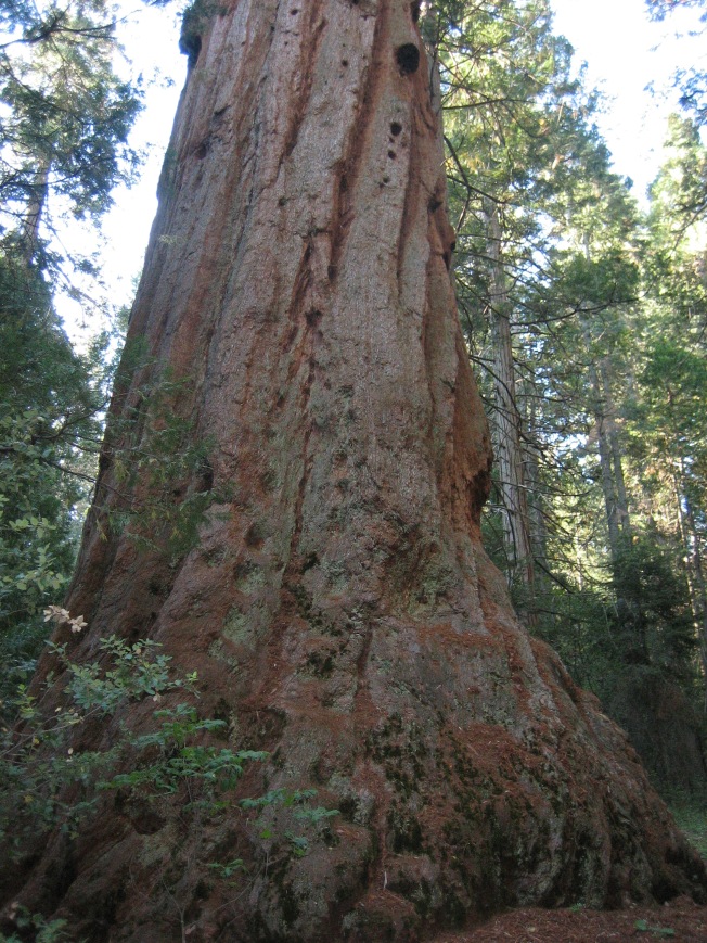
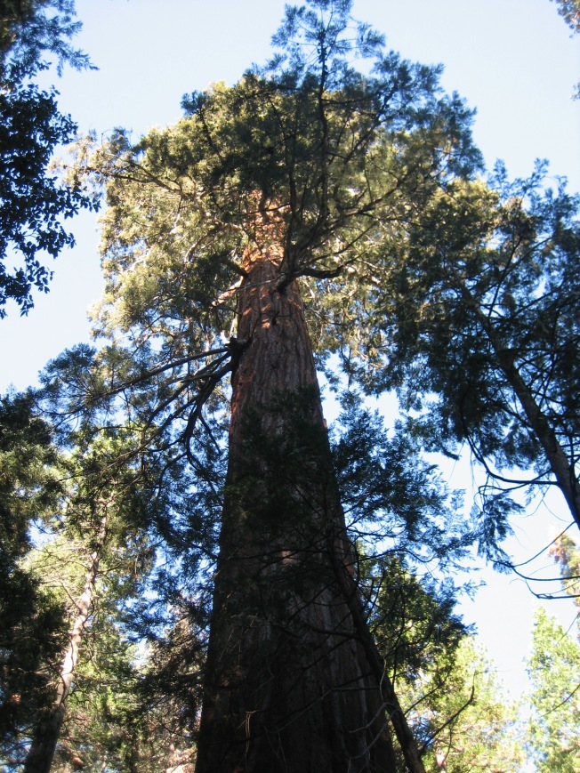
I took the photos in this post. All were taken during the Sherman Peak hike, except for the one of the giant sequoia.

Today is Arbor Day

Standard

I was scheduling posts for April when I looked at my paper calendar and saw April 27 was marked “Arbor Day.”

Arbor Day? That’s about trees, right? I thought.

This tree stands somewhere in Southern New Mexico.

I have a lot of photos of trees, I thought. I could do a post on Arbor day and share photos of trees, I thought.

These giant sequoias live in California’s Sequoia National Park.

According to the Arbor Day Foundation,

Arbor Day is an annual observance that celebrates the role of trees in our lives and promotes tree planting and care.
The idea for Arbor Day in the United States originated in Nebraska City, Nebraska
when settler Julius Sterling Morton proposed a resolution to the State Board of Agriculture.
In 1872, the State Board of Agriculture accepted a resolution by J. Sterling Morton “to set aside one day to plant trees, both forest and fruit.” The Board declared April 10 Arbor Day and offered prizes
to the counties and individuals that properly planted the largest number of trees on that day.

These olive trees grow in Phoenix, AZ. The palm tree, it turns out, is not really a tree at all. According to Earth Connection, “Palm trees, of which more than 2,000 species exist, are grouped botanically with grasses, sedges, bamboo, grains, lilies, onions, and orchids.”

As an April 2017 Time article called “This Is Why Arbor Day Is a Thing” explains,

Nebraska was a largely treeless prairie region when, on April 10, 1872, it became the first state to celebrate Arbor Day by planting trees.

A century after the holiday was first celebrated, the Arbor Day Foundation was created to continue encouraging people to plant and love trees, and President Nixon proclaimed National Arbor Day. Now the last Friday in April is National Arbor Day, which is when most but not all states celebrate it.

Evergreens in the snow in the mountains of California.

The USA is not the only country that celebrates trees! According to Wikipedia,

Arbor Day (or Arbour; from the Latin arbor, meaning tree) is a holiday in which individuals and groups are encouraged to plant trees. [1]Today, many countries observe such a holiday. Though usually observed in the spring, the date varies, depending on climate and suitable planting season.

(See the aforementioned article for a long list of countries that celebrate some version of Arbor Day, as well as a summary of what goes down at those celebrations.)

This tree in Northern New Mexico welcomes the night in the spring of 2017.

I hope you have enjoyed this brief history of Arbor Day and these photos of trees. I also hope you can get out there and celebrate Arbor Day by planting one or more trees.

The General Sherman is not only the largest living tree in the known world; it is the largest living creature of any species in the known world.

All of the photos in this post were taken by me.

Leaving the Mountain Again

Standard

I left the mountain this morning. I won’t see it again for at least seven months.

I didn’t sleep well last night. I hardly ever do before a big trip, but last night I was filled with worry. I was wide awake at 4:30 this morning. I went ahead and got out of bed and prepared to roll.

Yesterday was foggy and drizzly at the campground. When I tried to open the doors on my van this morning, I had to give them an extra tug because they were a little bit icy and the ice was holding them extra shut. My windshield was iced over too. As soon as I got the door to the driver’s side open, I started my engine and kicked on the defroster. The ice was melted by the time the van was packed.

The Big Boss Man sent me an email last night and asked me to stop by his trailer before I left this morning, so I did. He wanted to tell me that my name had come up twice at the company meeting he’d just returned from. I was the only non-managerial employee mentioned. Two highers-up in the company said what a great job I did in the mercantile this summer. They really want me to come back next summer, which means The Big  Boss Man really wants me to come back next summer. He said when his employees do a good job, it reflects well on him.

It was still dark as I made my way down the mountain. I got to see the sky gradually lighten until morning broke and the earth was blanketed in a beautiful golden brightness. I stopped in the first little town on my route, gassed up and bought a rather disappointing breakfast burrito. This is what I left behind me:

The highlight of my drive was a forest of Joshua trees. I’d driven through this forest in 2015 and have always regretted that I didn’t stop to take photos. Today I remedied the situation.

Despite my worries of last night, my van and I made it fine to tonight’s destination. I did have to get a jump start in the truck stop parking lot. I drove through one of those safety corridors where drivers are supposed to turn on their headlights. I dutifully turned mine on, but forgot to turn them off. My laundry was almost dry when a man in the Subway portion of the truck stop asked who the van belonged to. When I said it was mine, he said, Your lights are on. Oh no! I rushed outside and turned them off, but it was too late. After folding my clothes and putting them away, making my bed, and tidying the van, I tried to start the engine, but it just wasn’t happening. The nice man parked next to me helped, much to my relief.

I’m very tired, and I can’t wait for the sun to set so I can hunker down at the truck stop and get some much needed sleep. Tomorrow, my adventure continues.

I’m happy to move on to something new, but as always, I’m going to miss those giant sequoias.

I took the first two photos in this post. Photo of me hugging the giant sequoia by The Man.

The Stagg Tree

Standard

img_6581

According to Wikipedia, the Stagg Tree is the fifth largest giant sequoia in the world. It is the largest giant sequoia in the Sequoia National Monument within the Sequoia National Forest, and the largest giant sequoia outside the Sequoia & Kings Canyon National Parks.

img_6582The tree’s Wikipedia entry says the Stagg Tree is located

in Alder Creek Grove in California‘s Sierra Nevada mountains.

The tree is NOT in Deer Creek Grove, as was stated on another website I looked at. (I have visited both the Stagg Tree and Deer Creek Grove, and they are nowhere near each other. They are over 40 miles apart!)

According to the tree’s Wikipedia page, the tree was first called the Day Tree, presumably in honor of “L. Day” who

noticed the tree in 1931 and, with help from two others, made measurements of it in 1932.

In 1960 the tree was renamed in honor of

Amos Alonzo Stagg (1862-1965), a pioneering football coach at the University of Chicago who spent much of the last several decades of his life coaching in Stockton in the nearby San Joaquin Valley.

The Wikipedia page also says img_6584

Wendell Flint, the author (with photographer Mike Law) of To Find the Biggest Tree, measured it in 1977 as follows:

Metres Feet
Height above base 74.1 243.0
Circumference at ground 33.3 109.0
Diameter 1.5 m above base 7.05 22.9
Diameter 18 m (60′) above base 5.6 18.2
Diameter 55 m (180′) above base 3.8 12.5
Estimated bole volume (m³.ft³) 1,205.0 42,557.0

Presumably the tree has grown in the last forty years and is even larger than these statistics indicate.

The Stagg Tree grows on private land, but when I visited in the summer of 2016, the tree was accessible to the public.

The tree can be reached from Highway 190, which passes through Camp Nelson, CA and on to the small community of Ponderosa. (Another website I looked at says some navigation systems suggest accessing the tree by turning onto Wishon Drive [County Road 208] toward Camp Wishon. Apparently the road suggested is unpaved and closed in winter. This route is probably not a good idea for most cars.)

From Highway 190, turn onto Redwood Drive. (Redwood Drive is only on one side of the road, so you don’t need to know if you are turning left of right. Simply turn onto the road, which Google Maps also labels as 216.) When you get to the first fork in the road, stay left. At the second fork in the road, stay right to stay on Redwood Drive. At the third fork, stay left to stay on Redwood Drive. (If you take the right fork, you will be on Chinquapin Drive and you will be lost! If you do get lost, ask anyone walking around how to get to the Stagg Tree. The locals know how to get there.) I believe there is a sign pointing in the direction of the Stagg Tree at img_6598the last fork in the road.

If I remember correctly, the pavement ends before the parking area. Keep driving on the dirt road until you img_6597see the sign that says you’ve reached the parking area for the Stagg Tree hike. After you’ve parked, you have to cross a gate to start the hike to the tree. The gate may be closed and locked, but unless new signs say otherwise, it is ok to cross the gate on foot and walk to the Stagg Tree.

There are several signs along the path marking the way to the Stagg Tree.

The walk to the tree is fairly easy. It is not wheelchair or stroller accessible, but healthy folks with no mobility issues should be able to get there and back with no problem. The path is fairly flat until the last fork to the left . The path that branches off from the last fork is a bit steep (downhill to get to the tree, and uphill to get back.) Again, folks with no mobility or health issues should be able to make it to the Stagg Tree and back with a minimum of stress.

img_6587The Stagg Tree is not a heavily visited area. When I visited, I was the only person there. As I was walking toward the tree, another group was leaving, and as I left, another group was arriving, but I got the Stagg Tree all to myself for at least thirty minutes.

I’m not sure why the tree is less visited than other attractions in the area. Maybe drivers are leery of making a drive taking them so far off the main highway. Maybe most tourists who aren’t big into hiking are hesitant to go on a infrequently populated, unpaved, slightly steep trail. Maybe folks who are regular hikers think the short, easy hike to the Stagg Tree is beneath them.

In any case, I enjoyed my time alone with the Stagg Tree. It’s a great tree to visit to get away from the crowds and experience the sites and sounds of nature. Its size is quite impressive, and it’s fun to tell friends about seeing one of the largest creatures on the planet.

I took all of the photos in this post. The Stagg Tree is the giant sequoia in all of the photos.

img_6589

Winter Wonderland

Standard

img_7642It wasn’t even winter yet, when I visited Calaveras Big Trees State Park. It was only December 1, but already ice and snow covered the ground.

I hadn’t considered how a 1,500 feet increase in elevation can make a big difference in temperature and weather, so I was a bit surprised to see ice and snow on the side of the road as the van climbed above the 4,ooo feet mark. This is going to be fun, I thought.

Luckily, I was properly dressed with hiking boots, jeans, a warm sweater over a long sleeve t-shirt, and my jorongo over it all. Thankfully, I remembered to grab some gloves before I left the van.

The Calaveras Big Trees State Park is proud of their trees. It costs $10 per vehicle for admission, unless you’re arriving in a bus. Buses carrying up to 24 passengers have to pay $50 for admission. It costs $100 to bring in a bus carrying more than 24 passengers. You can bet I’m going to inform people of these prices next summer when they complain about paying $5 to park where I work.

I started my State Park adventure in the visitors center. The very friendly man who took my $10 at the entrance img_7643told me that’s where I could pick up a guide for the North Grove trail. The man didn’t tell me they want 50 cents for the guide. I hadn’t put any money in my pockets because I hadn’t planned to buy any souvenirs, and I didn’t think the trees were going to panhandle me. When I told the women in the gift shop area of the visitors center that I hadn’t brought any money in with me, she told me to pick up a guide from the metal box at the start of the trail.

I took the guide that looked as if it had already been borrowed and returned. Upon seeing the guide, I understood why the park wants to collect some money for it. The guide is a booklet (not one page folded in three parts, which is what I think of as a trail guide due to what I’ve given out where I work), five letter size pages folded in half. The guide includes a lot of information.

Before I took the guide and started my icy hike, I walked through the gift shop to the exhibit area of the visitor center. In the middle of the room was a display of taxidermied animals. I didn’t stop to examine them, as I don’t particularly like seeing animals killed so humans can look at them. I did look at the exhibits on the walls, which started with information about the native people who lived in the area before the miners and pioneers showed up. There was also information about the “discovery” of the trees in the park by white folks and the subsequent destruction of some of the largest ones.

The stairs lead up to the stump of the Discovery Tree, planed smooth for dancing.

The stairs lead up to the stump of the Discovery Tree, planed smooth for dancing.

One of the trees destroyed was called the Discovery Tree. According to the guidebook,

[i]n 1853…[this tree] was stripped of its bark and felled by ambitious speculators. Since no saw was large enough, the tree was felled with…long-handled pump augers and wedges…It took five men 22 days to drill all the holes, but the perfectly symmetrical tree did not fall for several days.

The stump was planed smooth to serve as a dance floor, and a two-lane bowling alley and bar were built on the fallen trunk.

John Muir…was so angered by these events that he wrote: The vandals then danced upon the stump!

The North Grove trail took me to the remains of the Discovery Tree. It is enormous! It’s difficult to understand from photographs how huge this

This photo shows the fallen trunk of the Discovery Tree, upon which a bar and bowling alley were built.

This photo shows the fallen trunk of the Discovery Tree, upon which a bar and bowling alley were built.

tree is. I climbed carefully up the icy steps and stood on the stump of the Discovery Tree. I felt very sad when thinking about  this tree being killed by people who wanted to make money exhibiting its parts. The trail guide says the tree was only 1.244 years old when it was cut. Since some giant sequoias live to be over 3,000 years old, the Discovery Tree may have had many more years of life ahead of it, had it not been destroyed in its prime.

Another tree in the park destroyed by humans was the Mother of the Forest. The trail guide says,

In 1854 the “Mother of the Forest…” was stripped of its bark. Promoters schemed to ship the bark strips back east for reassembly at exhibitions…A crew of men worked at the tree’s systematic destruction for  ninety days…It was through the Mother of the Forest’s great sacrifice that a heightened awareness about the need to protect these trees was born.

The Mother of the Forest stripped of its bark

The Mother of the Forest stripped of its bark

At the back of the exhibit area in the visitors center is a theater running a couple of documentary films on a loop. The films give a history of the park, including how the destruction of the Discovery Tree and the Mother of the Forest led to people working to protect the trees, including the creation of Calaveras State Park.

After my time in the visitors center, I started out on my walk through the trees. I found the trail was covered in ice and snow: no clearing the trail or shoveling snow here! The trail was only visible because the snow had been packed down where people had walked. The packed snow in the middle of the trail had turned to ice and was very slippery. I wished I had remembered to carry my walking stick with me. To avoid the worst of the icy slippiness, I mostly walked on the edge of the trail, where the snow was still crunchy and my boots could gain some traction. Unfortunately, walking through the snow meant repetitively sinking up to my ankles.

Still, I was glad I was there. I didn’t feel uncomfortably cold, and I enjoyed the img_7674extra quiet the blanket of snow brought to the forest. When the sun broke through the clouds and trees and hit the ice and the whole world shimmered, well, those moments were glorious.

The North Grove of Calaveras Big Trees State Park is the sixth grove of giant sequoias I’ve visited. I think my trek through the ice and snow to look at new giant sequoias makes it official: I’m a fanatic!

This photo shows me walking through a gap cut in a tree called Hercules. The trail guide says Hercules "was one of the largest in the grove. It was blown down during a violent windstorm in December 1861.

This photo shows me walking through a gap cut in a tree called Hercules. The trail guide says Hercules “was one of the largest in the grove. It was blown down during a violent windstorm in December 1861.”


The George Bush Tree

Standard

img_6486

I was looking for a waterfall the day I found the George Bush Tree.

According to the Sequoia National Forest’s website, the President George H.W. Bush Tree is part of Freeman Creek Grove (4,192 acres), also known as Lloyd Meadow Grove, which is

the largest unlogged grove outside of a National Park. This grove is the easternmost grove of giant sequoias and is considered to be among the most recently established. The sequoias are mainly south of Freeman Creek with approximately 800 large trees (10 feet in diameter or more). There are several large sequoias to see in this grove. Foremost among these is the President George H.W. Bush Tree.

National Geographic’s Sierra Nevada Geotourism webpage elaborates, stating

[t]here are a couple trees with a diameter of 20 feet, more than 100 with 15-foot diameters, and over 800 with 10-foot diameters.  There are estimated to be over 2,000 sequoias with a diameter of over 5 feet in the grove.  The largest tree in the grove measures 255 feet high with a diameter of 23 feet.

img_6506The aforementioned National Geographic website explains how this tree came to be named after the 41st President of the United States.

This tree was named for President George H. W. Bush in response to the proclamation he signed to protect all of the sequoia groves throughout the Sierra.  President Bush himself signed the proclamation at this site.

On the day I was trying to find the waterfall, I drove and drove and drove on Lloyd Meadow Road. I never saw the waterfall or even a sign marking the trail to it, but I eventually saw a brown sign marked “George Bush Tree.” I figured I should go see the tree since I was there anyway.

I turned down the decent dirt road (20S78) to the left of the brown sign. I drove about a mile down the road to the small parking area. There was no attendant and no fee to park. The start of the trail was marked with a carsonite. There was no indication of which way to go on the trail. The trail is a loop, and I started off in the direction that brought be around the back of the George Bush Tree. Since I didn’t see the stone plaque identifying the special tree, I didn’t realize it was the tree I had come to see.

The first thing I noticed about the tree was a sort of Hobbit hole at the bottom of it. I went right over to investigate. img_6485Yes, it was just large enough for me to crawl into the hole and sit down, so I did. I felt very safe while I was inside the tree, as if the tree were protecting me. I spent some of my time enveloped by the tree enjoying the quiet of the forest. I sat still and listened to the birds and the breeze high above me. I sat in the tree and simply was myself, without moving or talking or thinking.  I spent the rest of my time in the tree taking selfies.

When I exited the tiny hideaway, I walked around to the front of the tree and realized this was the tree I was looking for!

img_6502It is easy to identify the George Bush Tree from the front, because of the large stone marker. The aforementioned National Geographic webpage tells us what the plaque says.

THIS GIANT SEQUOIA TREE IS DESIGNATED THE GEORGE BUSH TREE IN CELEBRATION OF THE PRESIDENT’S ACTION AT THIS SITE ON JULY 14, 1992 TO MANAGE GIANT SEQUOIA IN PERPETUITY AS UNIQUE OBJECTS OF BEAUTY AND ANTIQUITY FOR THE BENEFIT AND INSPIRATION OF ALL PEOPLE.

While the George Bush Tree is very big, it doesn’t even make the Wikipedia list of the 48 largest giant sequoias. According to the list, at least two other trees in the Freeman Creek Grove are larger than the George Bush Tree. The first of the two larger trees is the Great Goshawk at 255.2 feet (77.8 m) tall with a circumference of 90.2 feet (27.5 m), a diameter of 28.7 feet (8.7 m), and a bole volume of 32,783 cubic feet (928.3 m3). The second of the larger trees in the grove is the Bannister at 195.0 feet (59.4 m) tall with a circumference of 95.0 feet (29.0 m), a diameter of 30.2 feet (9.2 m), and a bole volume of 25,047 cubic feet (709.3 m3).

The trail to the George Bush tree is unpaved, but I found it very easy to walk. I visited on a Monday morning, and I saw no other people on the trail or in the parking area.

Here’s how to get to the Freeman Creek Grove and the George Bush Tree, according to the Forest Service:

 To reach the grove by paved road, you must travel from the south end. From the San Joaquin Valley Highway 99 take County Route SM56 east about 20 miles to California Hot Springs. At California Hot Springs, turn north on to SM50 (Parker Pass Road) continuing about 7.5 miles to Johnsondale. From the Kern Valley, take County Route SM99 (Mountain 99) northwest about 20 miles to Johnsondale. At Johnsondale is the junction with Forest Road 22S82 (Lloyd Meadow Road). Take FR22S82 right about 16 miles to the eastern end of Freeman Creek Grove.

Another route from the San Joaquin Valley Highway 99 is on State Highway 190. Take Highway 190 east about 15 miles until the junction with Western Divide Highway (County Route SM107). Quaking Aspen Campground (GPS NAD 83: 36.12083, -118.54722), and the trailhead for FT 33E20 are also at this junction.

The day I visited the George Bush Tree was a good day of exploration; not only did I see a named tree I hadn’t seen before, but I was also able to add Freeman Creek Grove to the list of giant sequoia groves I’ve visited.

img_6499
I took all of the photos in this post.

Leaving the Mountain

Standard

Today’s the day.

After twenty-one weeks on the mountain, today is the day I leave.

What I will miss:

Deep silence

A steady paycheck

A safe place to sleep at night

Having giant sequoias for neighbors img_6344

Laughing with my coworker

The opportunity to see Steller’s jays and pileated woodpeckers

My creek sanctuary

Trees upon which I can hang my hammock

What I won’t miss:

The smell of pit toilets

Cleaning the smelly pit toilets

Idiots (although I know I can encounter dumb folks anywhere)

Being required to be friendly when I want to be left alone

The twenty-five mile round trip to the post office

Intensely curvy mountain roads

Answering the same questions repeatedly

The plague of flies I’ve lived with most of the summer

Sap on my windshield

What I will be glad for:

Frequent hot showers

Cell phone service

Internet access

Easy communication with people I love

Access to ice that doesn’t involve a twenty-five mile round trip

Activities I am eagerly anticipating:

Reuniting with friends

Attending my first opera

Collaborating on my first mural

Self-publishing my first book

Visiting new places

Nolagirl says the trick to fighting off depression is to keep moving forward. Today I’m taking one step, two steps, three steps, four into the future.

Goodbye mountain. I hope to see you next year.

img_6800

I took the photos in this post.

The Trail Is Closed

Standard

I made it to California.

I made it to the general vicinity of my summer workplace

I made it through two days of boring (and dare I say, mostly useless) training.

And then I made it up the mountain.

I’m not yet stationed at my campground. I’m currently the temporary camp host at the campground next door to the parking lot for the trail. I’ll be there until the first of June, when the real camp hosts for that campground arrive (in a bus painted Ohio State colors, apparently).

When I arrived at the campground, the gate was still closed. No signs were hung on the signboards. The women’s restroom up front was locked, and none of my keys opened it. The men’s restroom was unlocked, but filthy. I had no cleaning supplies.  I had no toilet paper to stock the restrooms. I had no trash bags, and if I’d had any, I had no trashcans to put them in. On top of all of that, the crew who’d been in the campground cutting hazard trees had left tree debris everywhere. The campground looked like a war zone (or at least what I imagine a war zone in a forest would look like). I was not a happy campground host.

To make matters worse, the trail across the street was closed too. Forest Service employees were out there, cutting hazard trees. According to the Forest Service ,

Tree hazards include dead or dying trees, dead parts of live trees, or unstable live trees (due to structural defects or other factors) that are within striking distance of people or property (a target). Hazard trees have the potential to cause property damage, personal injury or fatality in the event of a failure.

I can’t vouch for what happens when a tree hits the ground and no one is there to listen (but I do have two words for you, baby: sound waves). When I was there to hear, falling trees were preceded by a huge cracking sound, followed by a reverberating thud. Such noise inspires awe, at least in me, but also in every other lay person who’s been standing near me when it’s happened.

So because the trail was full of hazard trees and because Forest Service folks were in there cutting the hazard trees, the trail was closed.

I didn’t talk to too many people about the trail on Thursday. The campground’s closed gate and the sign proclaiming Sorry, We’re Closed discouraged most people from even pulling their cars into the driveway. Some folks talked to the Forest Service employee stationed at the trail’s entrance. After the Forest Service guys went home (wherever home is to those guys), some folks parked on the road side of the campground’s gate to walk across the highway and read the sign warning of a possible $5,000 fine and six months in prison for anyone caught on the trail.

I had resigned myself to fact that the campground would not be opened that day, when fairly late in the afternoon I saw two men and their motorcycles outside the gate. I walked over to talk to them, and one of the men said plaintively, Are you really closed? He seemed tired and frustrated.

I told him we were closed. I suggested some other campgrounds down the road, but he said they’d already checked and found those campgrounds closed too. I explained the campground offered no toilet paper and no trash cans. I said I hadn’t been able to clean the restrooms. The man said he had his own toilet paper, could pack out his trash, and wouldn’t be offended by the state of the restrooms, as he had worked construction and was accustomed to portable toilets. After we talked awhile and I realized they were good guys, I decided What the hell, opened the gate and told them they could stay. They ended up staying three nights. Both of them were super nice guys, and I had several pleasant conversations with both of them. It was awesome to start the season (before the season had officially started) with nice campers.

I was able to officially open the campground on Saturday morning. People started coming through the gate before 11am. I did get one set of campers (a couple and their two dogs, none of whom gave me any trouble), but most of the people coming through the gate had come for the trail. After scrubbing the two front restrooms, I posted myself near the gate with a book. As car after car pulled in, I answered the questions of the visitors.

Yes, the trail is closed.

It’s closed because their are many hazard trees on the trail. The Forest Service is in the process of cutting down the hazard trees. It’s dangerous on the trail.

The drought killed the trees. Well, the drought and the bark beetle and some kind of mold. But mostly the drought. Because of the drought, the trees’ defenses were down and they couldn’t fight off the bark beetle and the mold.

Yes, the campground is open.

Yes, the restrooms are open. These up front are wet because I just cleaned them, but you are welcome to use the ones at the back of the campground.

There are giant sequoias in the campground. (pointing) There’s one. (pointing) There are three over there. (pointing) There are four over there. You are welcome to park your car and take a look around.

I also gave a lot of people directions to the next grove of giant sequoias, about twenty miles away.

Sunday was a little slower, but otherwise the same.

The highlight of Sunday was another set of nice campers, this time a family recently moved to Tucson with a Grateful Dead dancing bear sticker on the back window of their Volvo. They asked me questions about the trees in the campground, and I got to give my talk about the differences between giant sequoias and coastal redwoods.

So now I’m on my second of two days off and will go back up the mountain in a few hours.

I don’t know what the state of the trail will be when I get back up there. Forest Service workers were  there cutting hazard trees on Sunday. (Today’s our Monday, the young man monitoring the closed entrance to the trail told me cheerfully.) Last I heard, the Forest Service was planning to have the trail closed through the end of the month. Yep, closed for Memorial Day. If that’s how it works out, guess who’s going to get to talk to hundreds of disappointed visitors during the three-day weekend.

If you guessed it’s going to be me…you are correct. If you also guessed this is a duty I am not pleased about, you’d be correct about that too.

I took this photo of two giant sequoias which grew together and fused over hundreds (maybe thousands) of years.

I took this photo of two giant sequoias which grew together and fused over hundreds (maybe thousands) of years.

Deer Creek Grove

Standard

Deer Creek Grove is the southernmost grove of giant sequoias, “about 250 air miles south of northernmost Placer County Grove,” according to Dwight Willard’s excellent book A Guide to the Sequoia Groves of California. Willard goes on to say that the grove “…has about 35 mature sequoias strung along the creek, plus many younger trees. None are exceptionally large.”

Willard also explains that the grove was never logged for sequoias. “The grove was selectively logged for pine and fir only between 1914 and 1920, but has been preserved from cutting since then.”

The grove is in the Sequoia National Forest, near the small community of Pine Flat. It is a couple of miles from the California Hot Springs community.

I visited Deer Creek Grove early one morning when I was in the area in the summer of 2015.

IMG_3372

To get to the grove from Mountain Road 50, go straight (onto Mountain Road 56 toward Pine Flat) when Mountain Road 50 ends at Mountain Road 56. From Mountain Road 56, turn right when the road dead ends at Mountain Road 50. A sign labeled “Deer Creek Grove” will point you to a left turn onto forest road 23S04. Follow that winding gravel and dirt road for several miles, through ranch land, then forest. The road ends in a gravel parking area at the lower edge of the grove. When I visited, there was no sign, nothing other than the parking area and a dilapidated picnic table in a clearing to indicate that I had arrived.


Unlike other trails through (the admittedly few) sequoia groves I’ve visited, the trail through Deer Creek Grove is a real hike.

IMG_3197.JPG

The path is barely visible, marked only by other feet that traveled on it in the past. Some parts of the trail are on a somewhat steep incline. I thought I was in decent physical condition when I tried to hike through this grove, but I was soon huffing and puffing and panting as I ascended.

I wasn’t prepared for a real hike when I visited Deer Creek Grove. I was wearing a skirt when I really needed long pants to adequately protect my legs. I also really needed my walking stick to help me up the steep parts of the trail, but I’d left it in the van. I should have used a backpack to carry water instead of holding my bottle in my hands. I hadn’t been planning on mosquitoes either, but they were out in force, biting the hell out of me. The only bug repellent I had was some hippy dippy oily Tom’s of Maine stuff which made my skin greasy, but did absolutely zero to deter the mosquitoes.

IMG_3185

I didn’t stay in the grove very long. I didn’t hike the entire trail (which Willard says “…passes by all the grove’s good-sized trees”). I just wasn’t having much fun, so I decided to backtrack and leave. I did get a few nice photos before I left.

IMG_3189


IMG_3188

IMG_3191.JPG

IMG_3192

I took all photos in this post.


Questions

Standard

At my jobs as a camp host and parking lot attendant, I am asked a lot of questions. After over three months, I’ve heard some questions so many times, they no longer surprise me.

Here’s a list of questions I am asked repeatedly (and my most common answers).

Where is the General Sherman tree? (In the Giant Forest in the Sequoia National Park)

What’s in that big tank on your campsite? (Water) Can I have some of it? (No)

Where are the rock slides? (I have no idea)

Is there a river or stream up here where we can get wet and cool off? (No)

How long is the trail? (About a mile and a quarter)

How long does it take to walk the trail? (That depends on how many trees you hug)

What’s the elevation here? (About 6400 feet)

How do I get to [L.A., San Francisco, the Sequoia National Park, Bakersfield, Las Vegas, Palm Springs]? (Answers vary)

Where is a water fountain/faucet/spigot where I can fill my water bottle/wash my hands/get water for my dog? (Not here)

Is there a place around here to go on a hike? (I have a map you can look at)

Do you take credit/debit cards? (No because there are no phone lines or internet access here)

Where’s the nearest ATM? (8 miles that way)

Where is Crystal Cave? (In the Sequoia National Park)

Can my dog go on the trail? (Yes, on a leash)

Where’s the closest place to get food? (11 miles that way, but it’s not very good and the people who work there aren’t very friendly)

Is there a coffee shop around here? (The restaurant 11 miles away sells coffee…if you mean a Starbucks, no)

Are there picnic tables here? (Yes, there are five picnic tables in the day use area)

Can we have a barbecue here? (Only on a gas grill, if you have a permit)

Which tree here is the oldest/biggest/tallest? (I don’t know)

Where is the nearest campground? (200 yards that way)

Is there a gift shop here? (No)

Where can I buy gas? (25 miles that way, 40 miles that way, or 40 miles the other way)

Are there bears here? (Yes, but they are timid because they are hunted here…you’re more likely to see a rattlesnake here)

Where’s the restroom? (In the little building in the middle of the parking lot)

Some questions take me by surprise.

One day a young Asian woman with a fairly strong accent asked me if we had a resting room. I thought she meant restroom (toilet, WC, el baño), so I told her it was in the little building in the middle of the parking lot. She was clearly exasperated and said not a restroom, a resting room. I was perplexed and just looked at her. She explained she wanted to leave her mother, an elderly woman using a cane, in a resting room with chairs and shade. I guess she wanted a waiting room. I told her there was no resting room in the parking lot, and she clearly expressed additional exasperation. I didn’t even try to explain to her that the only rooms in the area are the two with the toilets and a tiny one for storage.

Another time, a family asked me how to get to the Big Chief. I knitted my brow and shook my head. (I do something with my mouth too, when I don’t know the answer, but I don’t know how to explain the expression.) I told them I’d never heard of it. They said it is the 7th largest giant sequoia, and it’s supposed to be in the area. I still had no information about its location to offer.

(According to https://en.wikipedia.org/wiki/List_of_largest_giant_sequoias, there is a Chief Sequoyah tree located in the Giant Forest Grove of the Sequoia National Park. It is listed as the 26th largest tree with a height of 228.2 feet (69.6 m), a circumference of 90.4 feet (27.6 m), and a diameter of 28.8 feet (8.8 m). There’s also Red Chief in Long Meadow Grove. Wikipedia lists it as the 41st largest tree with a height of 245.0 feet (74.7 m), a circumference of 80.6 feet (24.6 m), and a diameter of 25.7 feet (7.8 m). Maybe the family was looking for one of these trees.)

One Thursday was the day of weird questions.

It started when two young women and their two fluffy little dogs exited the trail. They walked right up to me, and one of the women asked, Can you suggest a good hike for dogs? I was momentarily at a loss, then said, I don’t really hike, and I don’t have a dog, so I don’t know a good hike for dogs. The woman thanked me, and they all walked away. (Perhaps I should have offered use of my map, and the women and dogs could have consulted it and discussed their options.)

Later that day, I did pull out my map for a family to look at. The man asked me about the Pinnacle Trail. I said I’d never heard of it. He allowed that he possibly had the name wrong. I offered the map to him. He found the trail for which he was looking (the name of which has two syllables and does not begin with the letter “P”). They had a bunch of questions about the trail. I told them I’d never hiked it and could only say what I’d heard about it from other people. They kept asking me questions, and I kept saying I don’t know. Finally the oldest kid said, Are there big trees on the hike? I said, I don’t know; I’ve never been there, and I was done with them. Sometimes people insist I answer their questions, even after I’ve told them I can’t.

That afternoon I was patrolling at the nearby campground, and two men flagged me down to ask about the yurts. After I answered their questions ($75 a night, sleeps five, no cooking inside, bring your own bedding), they wanted to know about the closest rivers. I told them about the two rivers in the vicinity, and one guy asked me if the fishing were good. I said, I don’t know. I don’t fish. It seems to me he should have first asked me if I’d fished either river recently.

The strangest (or at least most strangely phrased) question of the day happened back at my campground. I was checking in two young Asian men (brothers). I pointed out my van and told them to let me know if they had any questions or problems. The one doing the talking asked if I stayed in the campground, and I said yes. The he asked, If someone arrives late at night, will you be here to assist them? I told him I would be here if someone arrived late, but when people arrive after dark, I stay in my van and check them in the next morning. I wondered what kind of assistance he had in mind. There are definitely certain kinds of assistance I will not provide!